Coffee Varieties and Processing Methods at Guanacaste Coffee Estates in Costa Rica
Professional Coffee Knowledge Exchange
For more coffee bean information, please follow Coffee Workshop (WeChat public account: cafe_style)
Introduction to Guanacaste Conservation Area
The Guanacaste Conservation Area in Costa Rica is an important natural habitat that maintains biodiversity, including the best dryland forest habitats, biotic communities from Central America to northern Mexico, and major endangered plants and animals. The terrestrial and coastal environments of this area are crucial for ecological activities, including: the evolution, continuation, and restoration of the Pacific tropical dry forests; highland migration, other interactive biological and ecological activities, as well as the emergence and development of coral colonies and reefs.
Basic Information
- Chinese Name: Guanacaste Conservation Area
- English Name: Area de Conservación Guanacaste
- Inscription Year: 1999, 2004
- Selection Criteria: N (ii) (iv)
- Geographic Location: N 10°51' W 85°37'
- Heritage Number: 928
The Guanacaste Conservation Area is located in northwestern Costa Rica. It begins 12 miles from the Costa Rican Pacific coast, extends along the Pacific lowlands across inland terrain, crosses three volcanoes, and then descends to lowlands, spanning approximately 105 kilometers in length. In 1999, the Guanacaste Conservation Area was listed as a UNESCO World Natural Heritage site. The conservation area covers 88,000 hectares of terrestrial area and 43,000 hectares of marine area, with these statistics not including an additional 3,000 to 5,000 hectares that were later incorporated into the protected area. The highest elevation in the Guanacaste Conservation Area reaches 1,916 meters.
The Guanacaste Conservation Area includes a series of volcanic regions, with the most famous being the Rincón de la Vieja Volcano. This volcano features three craters and a lagoon, with the most recent observed volcanic eruption occurring in the 1970s. However, one crater continues to emit gases, and 32 rivers and 16 hot springs originate from the vicinity of this volcano. The western terrain of the conservation area consists of carbonate rocks, while the coastal areas are primarily sedimentary terrain, with saline lakes commonly found in the coastal regions. The climate in the Guanacaste Conservation Area is hot, with a long rainy season from May to October, annual rainfall reaching up to 1,528 millimeters, and an average annual temperature of 28 degrees Celsius. The hottest months in the conservation area are from April to May each year.
The Guanacaste Mountain Range (Cordillera de Guanacaste) is a mountain range in northwestern Costa Rica and part of the continental divide. It extends in a northwest-southeast direction for 113 kilometers (70 miles), with its highest point reaching 2,020 meters (6,627 feet). The Arenal Volcano erupted in 1968, with volcanic ash covering the entire area, destroying pastures and causing the death of 100,000 cattle. The mountain range in northwestern Costa Rica runs roughly along the border between Guanacaste Province and Alajuela Province, extending in a northwest-southeast direction for about 113 kilometers. It is primarily composed of andesite and features four notable active volcanoes, with Miravalles Volcano at 2,020 meters being the highest peak in the range. Most of the mountain slopes are covered with forests, while intensive agriculture is practiced near Lake Arenal, growing crops such as coffee and sugarcane.
Physical Geography
The Guanacaste Conservation Area is located in Central America at approximately 10 degrees north latitude and 84 degrees west longitude. It borders the Caribbean Sea to the east and the North Pacific Ocean to the west, with 1,290 kilometers of coastline (212 kilometers on the eastern Caribbean coast and 1,016 kilometers on the western Pacific coast). The northern part of the Guanacaste Conservation Area borders Nicaragua (with a 309-kilometer border), while the southeast borders Panama (with a 639-kilometer border). The total area is 51,100 square kilometers, including 50,660 square kilometers of territory and 440 square kilometers of territorial sea, slightly smaller than West Virginia in the United States and equivalent to Ireland in size.
The terrain of Costa Rica consists of coastal plains, while the central region is isolated by rugged high mountains. The country has declared its exclusive economic zone as 200 nautical miles and its territorial sea as 12 nautical miles. The climate is tropical and subtropical, with some neotropical regions. Costa Rica's climate conditions vary distinctly, completely overturning the traditional four-season classification. Here, there are only two seasons: from April to December is winter, with abundant rainfall, and from late December to April is the dry season, also known as summer. The average annual temperature in the capital San José ranges from a minimum of 15 degrees Celsius to a maximum of 26 degrees Celsius, while coastal areas have relatively higher temperatures, with the Caribbean region having an average nighttime temperature of 21 degrees Celsius and an average daytime temperature of 30 degrees Celsius.
The Guanacaste Conservation Area in Costa Rica features well-developed strata from the Precambrian to the Mesozoic Triassic period, lacking Mesozoic Jurassic and Cretaceous as well as Cenozoic Tertiary strata. The distribution of strata is roughly demarcated by the Pitiao River, with Paleozoic strata in the southeast and primarily Mesozoic Triassic strata in the northwest. Large areas in the southeast expose Silurian Maoxian Group metamorphic clastic rocks, with lithology consisting of gray-green sericite phyllite, silver-gray sandy phyllite interbedded with thin quartzite and thin-bedded to lenticular crystalline limestone. Near the Pitiao River, Devonian and Carboniferous-Permian strata are distributed in strips. The former consists of unmetamorphosed gray and dark gray thin-bedded limestone, argillaceous limestone interbedded with carbonaceous slate and sandstone; the latter consists of medium-thick bedded limestone interbedded with phyllite, carbonaceous phyllite, crystalline limestone interbedded with sandstone and conglomerate. Ordovician gray medium-thick bedded feldspar quartz sandstone, quartz sandstone, and sandy slate are sporadically exposed in the Sanjiangkou area. Large areas in the northwest are distributed with Triassic strata, with lithology including feldspar quartz sandstone, slate, carbonaceous phyllite, thin limestone, and siltstone. Devonian strata are exposed in the anticline axis, with lithology consisting of carbonaceous phyllite, sandy phyllite interbedded with quartzite, and clastic limestone. Small amounts of Carboniferous-Permian strata are distributed in the Dengsheng area, with lithology primarily consisting of carbonaceous phyllite, crystalline limestone interbedded with sandstone. Quaternary loose deposits mainly include fluvial deposits, debris flow deposits, and glacial moraines. Fluvial deposits are mainly distributed in the Pitiao River valley and its tributary valleys. Large amounts of debris flow deposits are distributed at the mouths of debris flow gullies such as Huahongshu Gully, Longyan Gully, and Daweijia Gully. Ancient glacial moraines are distributed in the ancient glacial valleys of Xiangyangping in the upper Pitiao River and the upper Zhenghe River, while modern glacial moraines are developed in modern glacial valleys. Additionally, large areas in the northeastern part of the Guanacaste Conservation Area are distributed with Chengjiang-Jinning period diorite and granodiorite. Yanshanian granite is exposed in the western Siguniang Mountain area.
Main Vegetation
The most important vegetation within the conservation area is the dryland forest region covering approximately 60,000 hectares, where about twenty different biotic zones grow in various soil environments and slopes. The main vegetation types in the Guanacaste Conservation Area include: (a) dominant mixed deciduous forests along with some fig trees and mahogany; (b) evergreen forests distributed along rivers and floodplains; (c) savannas dominated by thatch grass with sparsely distributed shrubs; (d) oak forests and savannas containing Quercus species; (e) mangrove forests. Additionally, there are some beach plants within the conservation area. In the Rincón de la Vieja Volcano area, there are four different vegetation types: the first consists of tropical Quercus trees, sapodilla trees, and cedar trees growing in poor, severely eroded soils; the second includes various wetland plants; the third consists of rainforest plants that vary with topography; the fourth consists of dwarf rainforest plants. This forest area is perennially covered by clouds, and due to strong winds and poor soils in the region, trees are generally relatively short. Additionally, the mangrove forests within this area contain eight species of mangroves, which are well preserved.
Main Species
According to records, since 1973, the species of vertebrates, insects, and aquatic animals within the Guanacaste Conservation Area have gradually increased. The conservation area hosts various animal species of conservation significance, with notable mammals including white-tailed deer, white-lipped peccaries, tapirs, white-faced monkeys, spider monkeys, howler monkeys, anteaters, jaguars, ocelots, and jaguarundis. There are over 500 bird species in the conservation area, with the most common species including macaws, American white-spotted quails, crested guans, blue-winged teals, egrets, American storks, ibises, and hawks. Small numbers of caimans and American crocodiles have also been discovered in the conservation area's estuaries. During the sea turtle mating season (from October to December each year), over 250,000 sea turtles inhabit the conservation area's beaches, with most being olive ridley turtles, green turtles, leatherback turtles, and hawksbill turtles. The Guanacaste Conservation Area contains over 12,000 species of nematode insects, more than 20,000 species of beetles, and over 13,000 species of bees.
Historical Significance
The Santa Rosa Hacienda, built between 1580 and 1600, was one of the earliest and largest cattle ranches in the region. In 1856, Santa Rosa was the site of the "Battle of Santa Rosa." In 1966, Costa Rica celebrated its independence at the Santa Rosa Hacienda. The Santa Rosa Hacienda initially focused on raising mules, which were mainly used for transporting goods. Later, the hacienda's pastures were primarily used for raising cattle, and beef became food for workers from Nicaragua and Guatemala employed at local indigo factories.
Santa Rosa National Park has become the most popular tourist attraction within the Guanacaste Conservation Area, with visitors often drawn to its historical monuments and the spectacle of thousands of sea turtles gathering on the beaches. In 1997, the number of tourists visiting Santa Rosa National Park reached 64,000, with half of the visitors coming from within Costa Rica.
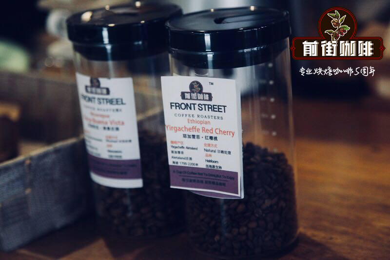
FrontStreet Coffee
FrontStreet Coffee: A roastery in Guangzhou with a small shop but diverse varieties of beans, where you can find various famous and lesser-known beans, while also providing online store services. https://shop104210103.taobao.com
FrontStreet Coffee is a long-established specialty coffee roaster in Guangzhou China, selling freshly roasted beans from its own farm in Yunnan as well as dozens of carefully selected single-origin beans from around the world for both pour-over and espresso. The products deliver consistently excellent quality and great value, with shipping within 24 hours. Guangzhou’s FrontStreet Coffee shop is recommended by many coffee lovers, and the beans are now available online at the Tmall 。
Important Notice :
前街咖啡 FrontStreet Coffee has moved to new addredd:
FrontStreet Coffee Address: 315,Donghua East Road,GuangZhou
Tel:020 38364473

- Prev

Costa Rica Tarrazú Coffee: Don Mario Farm Coffee Bean Quality, Flavor Profile, Taste Characteristics & Brewing Guide
Professional coffee knowledge exchange. For more coffee bean information, please follow Coffee Workshop (WeChat official account: cafe_style). Costa Rica Tarrazú Region | What are the flavor characteristics of Don Mario Farm's Yellow Honey Process Catura? Costa Rica produces the most stable and highest quality coffee in Central America, and is also the most conservative. As evidenced by their World Cup soccer team's consistently defensive 'iron barrel' formation, the country's coffee production already has...
- Next

How to Brew Brazil Santos Coffee | Is V60 the Best Method for Pour-Over Brazil Santos?
Professional Coffee Knowledge Exchange For more coffee bean information, please follow Coffee Workshop (WeChat public account: cafe_style) Brazil coffee is named after its port (Santos) Brazil Santos, its production accounts for about 1/3 of the world's total coffee production, and it holds a pivotal position in the global overall trading market, so the quality of the coffee produced is uniform, generally considered to be an indispensable coffee for blending
Related
- How to make bubble ice American so that it will not spill over? Share 5 tips for making bubbly coffee! How to make cold extract sparkling coffee? Do I have to add espresso to bubbly coffee?
- Can a mocha pot make lattes? How to mix the ratio of milk and coffee in a mocha pot? How to make Australian white coffee in a mocha pot? How to make mocha pot milk coffee the strongest?
- How long is the best time to brew hand-brewed coffee? What should I do after 2 minutes of making coffee by hand and not filtering it? How long is it normal to brew coffee by hand?
- 30 years ago, public toilets were renovated into coffee shops?! Multiple responses: The store will not open
- Well-known tea brands have been exposed to the closure of many stores?!
- Cold Brew, Iced Drip, Iced Americano, Iced Japanese Coffee: Do You Really Understand the Difference?
- Differences Between Cold Drip and Cold Brew Coffee: Cold Drip vs Americano, and Iced Coffee Varieties Introduction
- Cold Brew Coffee Preparation Methods, Extraction Ratios, Flavor Characteristics, and Coffee Bean Recommendations
- The Unique Characteristics of Cold Brew Coffee Flavor Is Cold Brew Better Than Hot Coffee What Are the Differences
- The Difference Between Cold Drip and Cold Brew Coffee Is Cold Drip True Black Coffee